Beyond the Ring Road: Hiking Siquijor's Interior Highlands and Forest Trails
Escape the coast and explore Siquijor's lush interior highlands on foot. A complete guide to inland hiking trails, jungle paths, and elevated viewpoints across the island's mountainous interior.
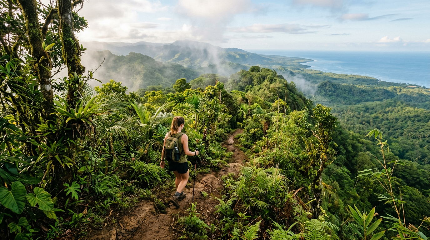
Every visitor to Siquijor drives the 72-kilometer coastal ring road at least once. It is the default way to experience the island: a loop past beaches, waterfalls, and seaside towns. But the ring road only shows you the edge of Siquijor. The interior — a green, elevated heart of tropical forest, small farming communities, and ridge-line trails with views that stretch to neighboring islands — remains unseen by the vast majority of visitors.
This guide is for travelers who want to leave the coast behind, lace up their shoes, and discover what lies beyond the ring road.
Why the Interior Is Worth Your Time
Siquijor’s interior is dramatically different from its coastline. While the coastal strip is flat, developed, and sun-drenched, the inland rises into rolling hills and forested ridges that peak at Mount Bandilaan’s 557-meter summit. Temperatures drop noticeably as you gain elevation. The air carries the scent of tropical hardwoods and wild orchids instead of salt spray. Birdsong replaces the sound of waves.
The interior is also where Siquijor’s traditional rural life continues largely unchanged. Small sitios connected by narrow paths still rely on farming, charcoal production, and the forest for their livelihood. Walking through these communities offers a window into daily life on the island that no coastal resort can provide.
During the dry season months from February through May, the interior trails are at their best. Paths that become slippery mud channels during the rains are firm and navigable. Stream crossings are manageable. And the reduced foliage density of the drier months opens up viewpoints that are otherwise curtained by leaves.
Trail Guide: Five Interior Routes
1. The Bandilaan Summit Trail
Distance: Approximately 4 kilometers one way from the park entrance Difficulty: Moderate Duration: 2 to 3 hours round trip Starting point: Mount Bandilaan National Park entrance, accessible by motorcycle from the ring road via the Cantabon or Lazi interior roads
This is Siquijor’s signature highland walk. The trail begins at the park facilities and climbs through secondary forest toward the island’s highest point. The path is well-defined for most of its length, though the final approach to the summit involves some steeper sections where you may need to use your hands on exposed roots and rocks.
The forest along the route is diverse. Lower sections pass through areas of cultivated coconut and fruit trees that gradually give way to denser tropical forest. Watch for Philippine hanging parrots, black-naped orioles, and the distinctive call of the Visayan tarictic hornbill. Butterfly diversity is remarkable throughout, with large birdwing species commonly seen along sun-dappled sections of the trail.
At the summit, a clearing offers panoramic views. On clear days, you can see Cebu to the northwest, Negros to the west, Bohol to the north, and Mindanao to the southeast. The four-island panorama is one of the most rewarding views in the Central Visayas, and you will likely have it entirely to yourself.
Practical notes: Start early in the morning to avoid midday heat at lower elevations and to maximize your chances of clear summit views before afternoon clouds build. Bring at least two liters of water per person. A local guide is recommended and can be arranged at the park entrance for a modest fee.
2. The Cantabon Ridge Walk
Distance: Approximately 3 kilometers one way Difficulty: Easy to moderate Duration: 1.5 to 2 hours one way Starting point: Cantabon village, municipality of Siquijor
This lesser-known route follows a farm road and footpath along a ridge east of Cantabon, offering continuous elevated views across the island’s interior. The trail connects Cantabon to a network of smaller sitios in the uplands, passing through a patchwork of coconut groves, small vegetable gardens, and patches of forest.
The walk is gentle by hiking standards, following the natural contour of the ridge without significant elevation changes. What makes it special is the sustained panoramic perspective. To the east, you look down over the forested valleys descending toward Lazi. To the west, the terrain slopes toward San Juan and the coast. The interplay of cultivated land and remaining forest creates a mosaic landscape that is visually striking and ecologically interesting.
This route is particularly beautiful in the early morning when mist fills the valleys below the ridge and the low sun illuminates the forest canopy in warm tones.
Practical notes: The trail is not formally marked. Ask at Cantabon village for someone to point you in the right direction, or better yet, hire a local to walk with you. The path is used regularly by residents, so navigation is straightforward once you are on it.
3. The Camagong Forest Loop
Distance: Approximately 5 kilometers loop Difficulty: Moderate Duration: 2.5 to 3 hours Starting point: Barangay Camagong, municipality of Maria
In the southeastern interior of Siquijor, the hills above Maria municipality harbor some of the island’s most intact forest cover. The Camagong Forest Loop follows farm tracks and footpaths through a mix of primary and secondary forest, with several stream crossings that are easy to navigate during the dry season.
The forest here feels genuinely wild. Canopy trees reach considerable heights, and the understory is thick with ferns, gingers, and climbing plants. The relative remoteness of this area means wildlife sightings are more frequent. Monitor lizards are commonly spotted along the trail, and the birdlife includes forest-dependent species less likely to be seen in degraded coastal habitats.
One highlight of this route is a series of small natural pools fed by springs emerging from the hillside. These are not tourist attractions — they have no facilities, no signage, and no entrance fees. They are simply places where local residents come to wash clothes or cool off, and where a passing hiker can rest and appreciate the quiet abundance of clean water that Siquijor’s limestone geology provides.
Practical notes: This trail requires a local guide. The path network is used by farmers and charcoal makers who know the routes intimately, but it would be easy for an unfamiliar walker to take a wrong turn. Arrange a guide through the barangay hall in Maria or ask at your accommodation for a recommendation.
4. The Lazi Watershed Trail
Distance: Approximately 6 kilometers one way Difficulty: Moderate to challenging Duration: 3 to 4 hours one way Starting point: Upper Lazi, accessible by habal-habal from Lazi town center
This longer trail follows the watershed area above Lazi, traversing terrain that supplies water to several of the municipality’s spring systems. The route is more demanding than the other trails listed here, with steeper grades and less-maintained sections, but it rewards effort with deep forest immersion and a strong sense of isolation.
The trail passes through areas of old-growth forest where the canopy is high and the undergrowth relatively open, creating a cathedral-like atmosphere. Large hardwood trees, some with buttress roots spreading meters from the trunk, stand as evidence of the forest that once covered the entire island. Epiphytic orchids and ferns cling to branches overhead, and the humidity beneath the canopy is noticeably higher than in more exposed areas.
Birdwatchers should consider this trail seriously. The undisturbed forest supports a concentration of Visayan endemic species, and the quiet, unhurried pace of a long walk gives ample opportunity for observation.
Practical notes: This is not a casual walk. Bring sufficient water, snacks, sun protection for exposed sections, and rain gear even in dry season as localized mountain showers can occur. A guide is essential. Start at dawn to allow plenty of time and to catch peak bird activity.
5. The San Juan Hillside Circuit
Distance: Approximately 3 kilometers loop Difficulty: Easy Duration: 1 to 1.5 hours Starting point: Upper San Juan, approximately 2 kilometers inland from the main road
For travelers based in San Juan who want a taste of the interior without committing to a full-day expedition, this gentle circuit through the hills immediately behind the town offers a convenient introduction.
The route follows a combination of concrete farm roads and earthen paths through the agricultural zone that transitions between the coastal tourism strip and the wilder interior. You will pass small farms growing vegetables, root crops, and herbs for the local market. Coconut palms give way to mango and jackfruit trees as you gain modest elevation. Small shrines and roadside sari-sari stores punctuate the route.
The views back toward the coast from the higher points of this circuit are excellent. You can see San Juan’s beaches from above, with the reef flats visible as lighter patches against the deeper blue of the Bohol Sea. Late afternoon is the ideal time for this walk, when the declining sun backlights the coast and the temperature is comfortable.
Practical notes: This is the most accessible interior walk on Siquijor. No guide is strictly necessary, though asking at your accommodation for the best starting point is advisable. The route is gentle enough for travelers of any fitness level.
What to Bring on Interior Hikes
Footwear is the single most important consideration. Closed-toe shoes with good grip are essential. Trail runners work well for the easier routes. For the longer, steeper trails, lightweight hiking boots provide better ankle support. Flip-flops and sandals are not appropriate for interior hiking, even in dry conditions.
Water availability on Siquijor’s interior trails is limited. There are no commercial outlets or water fountains once you leave the villages. Carry a minimum of two liters per person for shorter hikes and three to four liters for longer outings. The effort of carrying extra water is always preferable to the risk of dehydration in tropical heat.
Sun protection is critical for exposed sections of trail and the summit areas. A wide-brimmed hat, sunscreen, and lightweight long sleeves provide the best coverage. Sunglasses reduce the glare from pale limestone surfaces that can be surprisingly intense.
Insect repellent is worth applying before heading into the forest. Mosquitoes are present in the interior, particularly near water sources and in shaded areas. The risk is low during the dry season but not absent.
A basic first aid kit should include adhesive bandages, antiseptic wipes, and any personal medications. The interior trails are remote, and it may take time to reach medical facilities if needed.
Cash in small denominations allows you to pay guides, buy snacks or drinks at village sari-sari stores, and contribute to any informal entrance fees that communities may request.
Hiring a Local Guide
For all but the San Juan Hillside Circuit, hiring a local guide significantly enhances the experience and is often necessary for route-finding. Siquijor’s interior trails are working paths used by farmers, hunters, and charcoal makers. They are not signposted, and junctions can be confusing without local knowledge.
Guides can be arranged through several channels. Your accommodation is the easiest starting point — most guesthouse and resort operators know local residents who guide occasionally. The barangay hall in the municipality you intend to hike in can also connect you with knowledgeable locals. For Mount Bandilaan, guides are typically available at the national park entrance.
Expect to pay between 500 and 1,000 PHP for a half-day guide, depending on the length and difficulty of the route. This is money well spent. A good guide does not just show you the way — they identify plants, explain local land use, point out wildlife, and share stories about the places you pass through that no guidebook can provide.
Best Time for Interior Hiking
The dry season from February through May offers the best conditions. March is particularly favorable: the wet season is comfortably past, trails have had time to dry and firm up, but the extreme heat of April and May has not yet arrived.
Start hikes early in the morning, ideally departing by 6:00 or 7:00 AM. Morning temperatures are cooler, the light is beautiful for photography, and wildlife is most active. By midday, even interior trails can become uncomfortably warm, and afternoon cloud buildup may obscure summit views.
Avoid hiking during or immediately after rain, even isolated showers. Siquijor’s limestone-derived soils become slippery when wet, and stream crossings can rise quickly.
Connecting the Interior to the Coast
The beauty of exploring Siquijor’s interior is that it deepens your understanding of the entire island. The springs that feed the coastal waterfalls originate in the highlands you hike through. The timber in traditional houses came from the forests you walk under. The medicinal plants used by traditional healers grow along the trails you follow.
The interior and the coast are not separate destinations. They are connected systems, and walking through the highlands reveals those connections in a way that staying on the ring road never can.
For travelers willing to put down the motorcycle keys, lace up proper shoes, and follow a narrow path uphill into the green, Siquijor’s interior offers something increasingly rare in Southeast Asian tourism: genuine discovery, physical engagement with the landscape, and the quiet satisfaction of seeing a place that most visitors never know exists.
Related Travel Guides
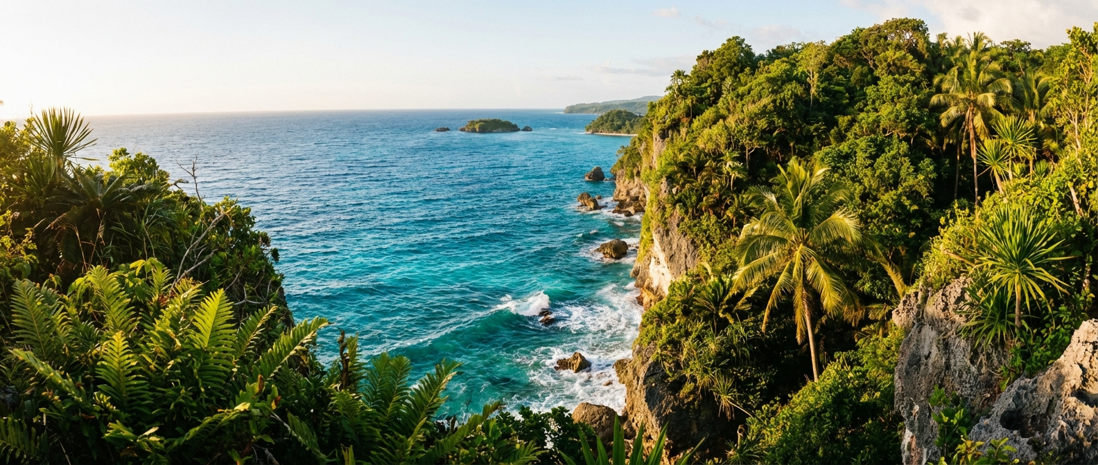
Siquijor's Best Cliff Viewpoints and Coastal Lookouts: A Complete Guide
Find the most stunning cliff viewpoints and coastal lookouts across Siquijor Island. From towering limestone bluffs to hidden hillside vantage points, this guide covers every major viewpoint with directions and visiting tips.
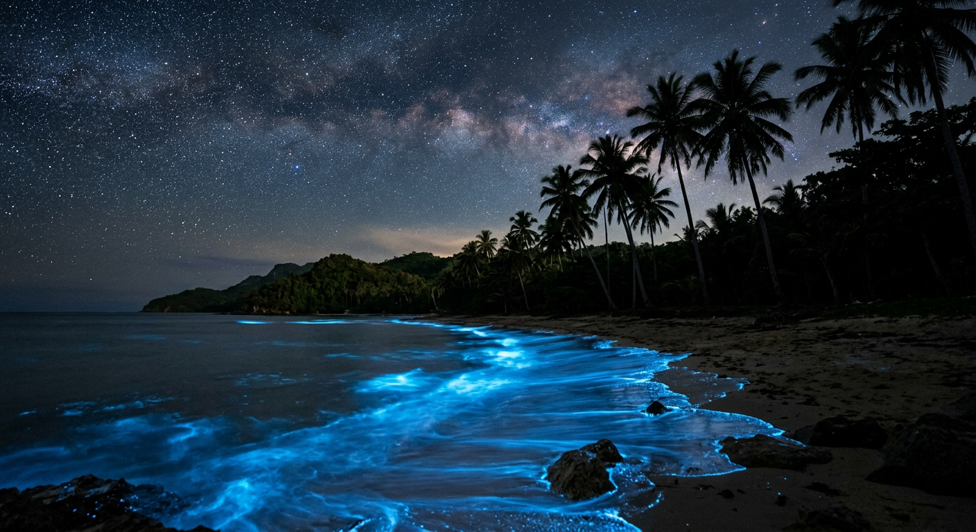
Siquijor Night Swimming Guide: Bioluminescent Waters and After-Dark Ocean Adventures
Discover the best spots for night swimming in Siquijor Island, from bioluminescent plankton encounters to moonlit beach sessions. Safety tips, timing advice, and local knowledge for after-dark ocean adventures.
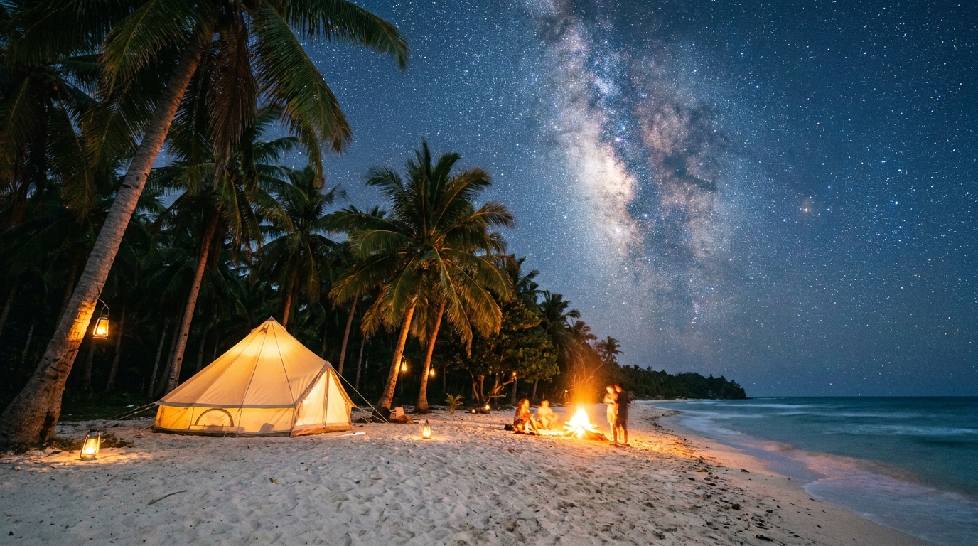
Beach Camping in Siquijor: Complete Guide to Sleeping Under the Stars
Everything you need to know about beach camping in Siquijor Island. From established campgrounds to wild camping spots, essential gear, permits, and the best beaches for an overnight under the stars.