Siquijor's Best Cliff Viewpoints and Coastal Lookouts: A Complete Guide
Find the most stunning cliff viewpoints and coastal lookouts across Siquijor Island. From towering limestone bluffs to hidden hillside vantage points, this guide covers every major viewpoint with directions and visiting tips.
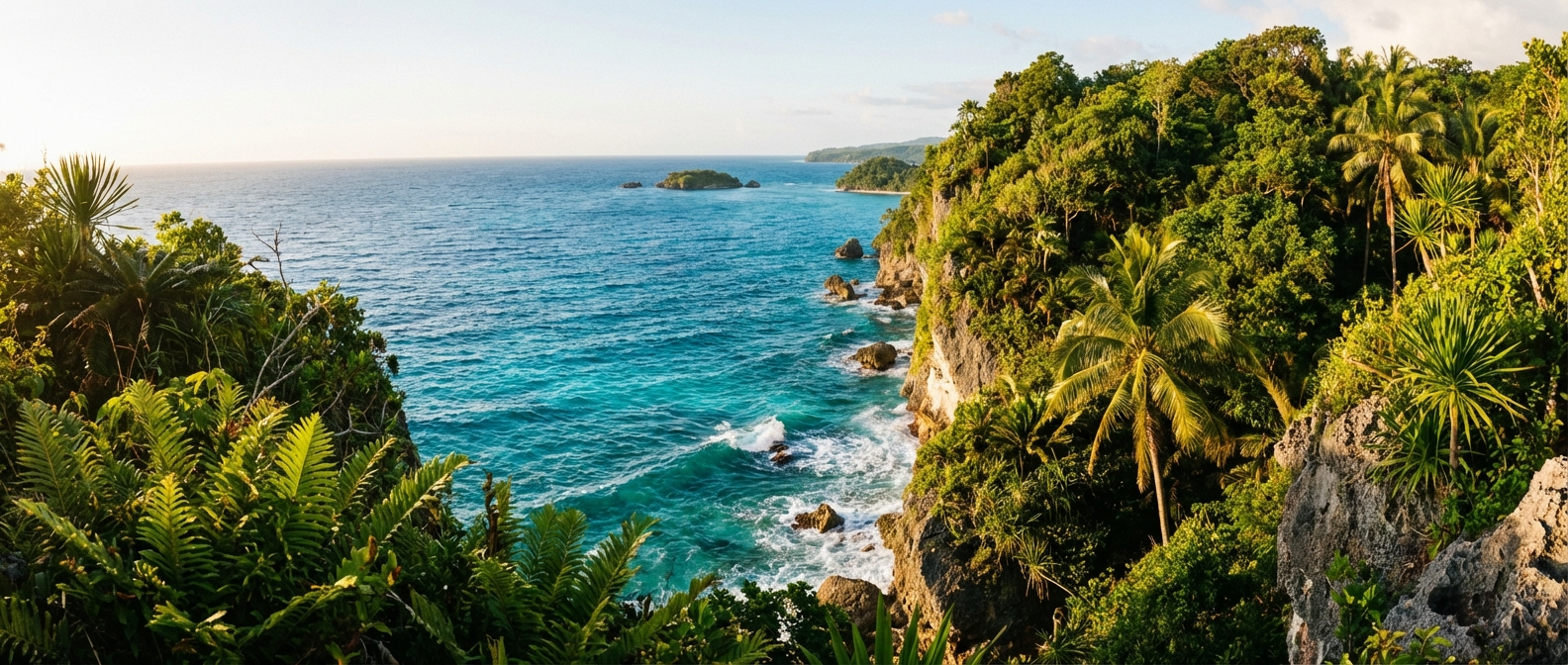
Siquijor’s coastline is defined by dramatic contrasts. Long stretches of white sand give way without warning to sheer limestone cliffs that drop straight into deep blue water. Inland, the terrain rises through coconut groves and forest to the highland plateau of Mount Bandilaan, where the entire island spreads out below like a map. For travelers who find satisfaction in earned perspectives and sweeping horizons, Siquijor delivers viewpoints that rival anything in the Visayas.
This guide maps out the island’s finest cliff viewpoints and coastal lookouts, from well-known spots with developed access to unmarked bluffs that require local knowledge and a willingness to explore. Each entry includes location details, access information, and practical tips for making the most of your visit.
The Eastern Cliffs: Maria and Lazi
The eastern coast of Siquijor features the island’s most dramatic cliff formations. The limestone bedrock rises steeply here, creating a series of elevated platforms with unobstructed views across the Bohol Sea toward Mindanao.
Salagdoong Cliffs, Maria
Salagdoong is famous for its cliff jumping platforms, but the broader cliff system extending along this section of coastline offers some of the most photogenic viewpoints on the island. The main viewing area sits roughly 15 to 20 meters above sea level, with clear sightlines along the coast in both directions.
The managed section of Salagdoong charges an entrance fee of 30 PHP per person as of early 2026. Facilities include concrete pathways, railings along the cliff edge, and shaded rest areas. For photography, the morning hours produce the best light, with the sun rising behind you and illuminating the turquoise water below the cliffs.
Beyond the main swimming and jumping areas, a rough trail continues southward along the cliff top. This path leads to several unmarked viewpoints where the coastline curves away in a series of rocky headlands. The terrain is uneven and unfenced, so caution is warranted, but the views are exceptional and the solitude is nearly guaranteed.
Getting there: From San Juan, head east along the coastal road through Lazi. Salagdoong is signposted approximately 5 kilometers past Lazi town proper. The road to the entrance is paved but narrow in sections.
Lazi Cliff Overlook
South of Lazi town, a section of the coastal road passes along the top of a limestone escarpment that offers direct views down to the water. There is no formal viewpoint here, just a stretch where the road runs close to the cliff edge with enough shoulder to pull over safely on a motorcycle.
The perspective from this section is particularly striking during the late afternoon when the low sun catches the texture of the cliff face and the water below shifts through shades of blue and green. The coral reef visible through the clear water from this height gives the scene an almost aerial quality.
Getting there: Follow the main coastal road south from Lazi toward Maria. The cliff-edge section begins roughly 2 kilometers past the town center and continues intermittently for about a kilometer.
Kagusuan Beach Cliff Trail
Kagusuan Beach sits at the base of a significant cliff system, and the approach trail from the road above provides elevated viewpoints before descending to the sand. The highest point of the trail, near the parking area, looks out over a wide arc of ocean with the beach far below. The descent is steep and requires reasonable fitness, but the viewpoint at the top is accessible to anyone.
The combination of height and the beach’s relative isolation makes this one of the more dramatic cliff-to-beach perspectives on the island. Early morning visits capture both the sunrise and the soft light that reveals the water’s color gradient from pale turquoise near shore to deep navy offshore.
Getting there: From the coastal road between Lazi and Maria, follow the signposted turnoff for Kagusuan Beach. A short dirt track leads to the cliff-top parking area.
The Western Coast: San Juan and Siquijor Town
The western side of the island presents a different character. Cliffs are generally lower and the coastline is more varied, mixing sandy stretches with rocky headlands. The viewpoints here are oriented toward the setting sun, making them prized for late-afternoon visits.
Paliton Sunset Cliffs
Paliton Beach is Siquijor’s most celebrated sunset location, but the rocky headlands flanking the beach on both sides offer elevated perspectives that surpass the beach-level view. The northern headland is accessible via a short scramble from the road above the beach. A flat rock platform at the top provides a stable vantage point roughly 8 meters above the water.
From this position, the view encompasses the full sweep of Paliton Beach, the coconut palm tree line that has become one of the island’s most photographed scenes, and the open ocean to the west where the sun drops below the horizon. During March, the sunset position aligns almost directly with the line of sight from these rocks, producing some of the most vivid evening skies of the year.
Getting there: Paliton Beach is signposted from the main coastal road in San Juan. The headland scramble starts from the road above the northern end of the beach, near where motorcycles typically park.
Cang-Anam Cove Overlook, San Juan
Between San Juan’s main tourism strip and the quieter stretches to the north, a series of small coves are cut into low limestone cliffs. The road passes above several of these, and at Cang-Anam, an informal lookout has developed where visitors stop to photograph the cove below. The water here is remarkably clear, and the coral formations visible from above create abstract patterns of color against the white sand bottom.
This is not a towering cliff viewpoint but rather an intimate elevated perspective that showcases the incredible water clarity that defines Siquijor’s coastline. The midday sun directly overhead produces the best color saturation in the water.
Getting there: Follow the coastal road north from San Juan center toward Larena. Cang-Anam cove is approximately 3 kilometers past the main San Juan strip. Look for a gap in the roadside vegetation with motorcycle tracks leading to the cliff edge.
Siquijor Town Port Overlook
The ferry port area of Siquijor Town sits on slightly elevated ground that provides views across the harbor and the strait toward Dumaguete. While less dramatic than the island’s natural cliff viewpoints, the perspective here captures the working side of island life: outrigger boats, ferries arriving and departing, fishermen mending nets, and the backdrop of mainland Negros rising in the distance.
The best vantage point is from the road above the port, particularly the stretch leading uphill toward the municipal hall. Late afternoon light illuminates the harbor scene beautifully, with the mountains of Negros Island catching the golden hour glow.
Getting there: The port area is in the center of Siquijor town, accessible from the main coastal road.
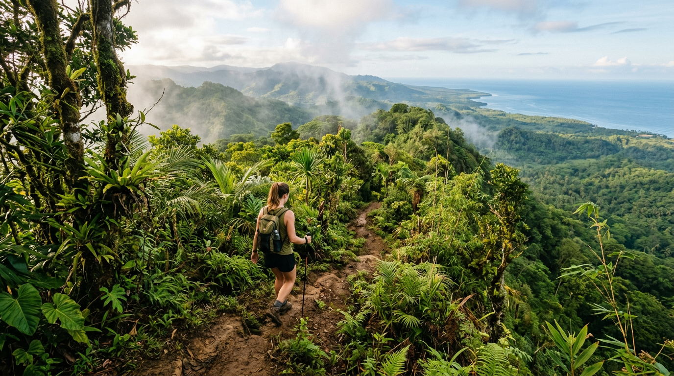
The Highland Interior: Mount Bandilaan
The interior highlands offer a fundamentally different viewpoint experience. Rather than coastal cliff perspectives, these locations provide panoramic views that encompass the entire island and surrounding seas.
Mount Bandilaan Summit
At 628 meters above sea level, Mount Bandilaan is the highest point on Siquijor and the island’s premier panoramic viewpoint. On clear days, the summit provides 360-degree visibility that extends to Bohol in the north, Cebu to the northwest, Negros to the west, and Mindanao to the south and east.
The summit is accessible by road, with a paved route winding through the Bandilaan National Park. A viewing platform and small pavilion mark the highest point. The combination of elevation and the island’s relatively small footprint means that from the summit you can see both the eastern and western coastlines simultaneously, an unusual perspective that reinforces just how compact and contained this island world is.
Morning visits before 9:00 AM typically offer the clearest conditions, before tropical haze and cumulus cloud buildup obscure the distant views. The temperature at the summit is noticeably cooler than the coast, often by 3 to 5 degrees Celsius, making it a refreshing escape from the lowland heat.
Getting there: The main access road branches off from the interior highway connecting Lazi and San Juan. The road is paved but steep in sections. Motorcycles handle it comfortably; larger vehicles should check road conditions during or after rain. The drive from San Juan takes approximately 30 to 40 minutes.
Bandilaan Butterfly Garden Viewpoint
The Butterfly Garden sits on the slopes of Mount Bandilaan at an elevation that provides excellent views of the southern coastline and the waters between Siquijor and Mindanao. The garden itself is a managed attraction with an entrance fee, but the viewpoint from the hillside above the garden is accessible from the road.
The vantage point here captures a layered landscape: forest canopy in the foreground, coastal settlements in the middle distance, reef-fringed shoreline below, and open ocean extending to the horizon. The afternoon light on this south-facing slope creates warm, saturated tones that photograph well.
Getting there: Follow the signs for the Butterfly Garden from the Bandilaan access road. The viewpoint is visible from the road approximately 200 meters before the garden entrance.
Interior Ridge Trail
A network of informal trails connects various points along the highland ridge that runs roughly east-west through Siquijor’s interior. Sections of these trails pass through dense forest before emerging at clearings that offer sudden, dramatic views of the coastline below.
The trail sections between the Bandilaan summit road and the village of Caipilan are particularly rewarding, with several natural viewpoints where the forest opens onto the northern coastline. These are not maintained tourist trails, and a local guide is strongly recommended for navigation and safety. Guides can be arranged through the barangay hall in Caipilan or through accommodations in San Juan.
Getting there: Access points vary. The most straightforward starting point is the Bandilaan summit road, where informal trail markers branch off at several points. A guide will know the specific entry points for the best viewpoints.
Photography Tips for Cliff Viewpoints
Light and Timing
The golden hours, the first hour after sunrise and the last hour before sunset, produce the most dramatic light at coastal viewpoints. The eastern cliffs around Maria and Lazi catch the best morning light, while the western viewpoints around San Juan and Paliton are optimized for late afternoon and sunset.
Midday light, while harsh for portraits, actually works well for overhead shots of the water below cliffs. The vertical sun angle penetrates the water most deeply, revealing coral formations and the full color gradient of the shallows.
Composition
The dramatic scale of cliff viewpoints demands compositional anchors to give the scene a sense of depth. Include foreground elements such as rocky outcrops, vegetation, or cliff-edge texture. A person standing at a safe distance from the edge provides immediate scale reference that transforms a flat ocean view into a dramatic landscape.
Safety
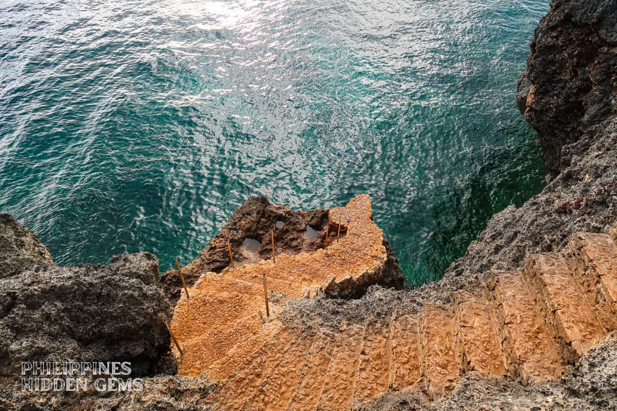
Cliff edges on Siquijor are natural limestone formations that can be undercut and unstable. Stay well back from unfenced edges, particularly after rain when surfaces may be slippery. Never lean over cliff edges for photographs, and keep a firm footing at all times. Several locations in this guide involve unmanaged natural terrain where falls could be fatal.
Practical Considerations
Getting Around
A rented motorcycle is the most practical way to access Siquijor’s viewpoints. Many locations involve short sections of unpaved road or informal trails that are not accessible by larger vehicles. Daily motorcycle rental rates in San Juan typically range from 350 to 500 PHP depending on the season and the bike model.
Tricycles can reach most of the coastal viewpoints but are less suitable for the highland locations where road conditions are variable. A full-day tricycle charter covering multiple viewpoints would cost approximately 1,500 to 2,500 PHP.
What to Bring
Carry water, sun protection, and sturdy footwear. Flip-flops are adequate for paved viewpoints like Salagdoong but insufficient for cliff scrambles and trail-based lookouts. A lightweight pair of trail shoes or athletic shoes with grip handles the full range of terrain.
A wide-brimmed hat is essential for viewpoints without shade, particularly during midday visits. The sun at elevation and on exposed cliff tops is intense, and prolonged exposure without protection leads to rapid sunburn.
Combining Viewpoints
A productive half-day loop covering the eastern cliffs might include Salagdoong, the Lazi cliff road, and Kagusuan, all within roughly 15 kilometers of each other. Pair this with a highland detour to Mount Bandilaan for a full day that covers both coastal and panoramic perspectives.
The western viewpoints around Paliton and Cang-Anam combine naturally with a sunset-focused afternoon. Arrive at Paliton by 4:00 PM, explore the headland viewpoints in the remaining daylight, and position yourself for sunset from the elevated rocks above the beach.
Siquijor’s viewpoints reward travelers who look beyond the beach. The island’s compact size means that dozens of elevated perspectives are accessible within a single day, each offering a different angle on the same small, beautiful piece of land. Whether you prefer the drama of sheer cliff faces dropping to deep water or the quiet grandeur of a highland panorama stretching to distant islands, Siquijor delivers viewpoints that justify the journey to reach them.
Related Travel Guides
Siquijor Photography Guide: Best Viewpoints & Photo Spots
Discover the most photogenic locations in Siquijor. From dramatic cliffs and panoramic viewpoints to waterfalls and beaches, find the best spots for stunning travel photos.
Beyond the Ring Road: Hiking Siquijor's Interior Highlands and Forest Trails
Escape the coast and explore Siquijor's lush interior highlands on foot. A complete guide to inland hiking trails, jungle paths, and elevated viewpoints across the island's mountainous interior.
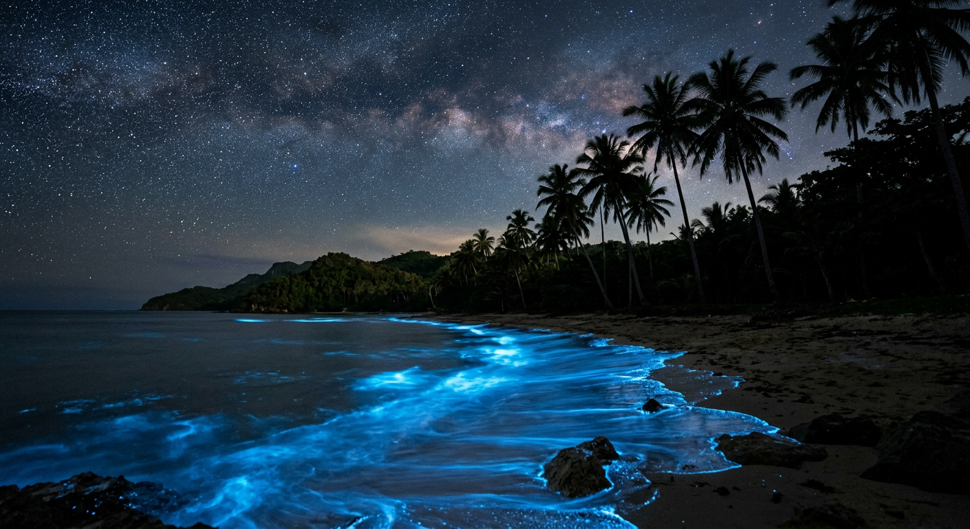
Siquijor Night Swimming Guide: Bioluminescent Waters and After-Dark Ocean Adventures
Discover the best spots for night swimming in Siquijor Island, from bioluminescent plankton encounters to moonlit beach sessions. Safety tips, timing advice, and local knowledge for after-dark ocean adventures.